Geo political extent type (UPDM - DoDAF aliases)

Creation
To create a Geo Political Extent Type:
• From an
Architectural Description or
Service Description: right-click the Architectural Description or Service Description, point to New, point to DoDAF, point to All, and then click Geo Political Extent Type.
• From an
AV-4 Environmental Model: click the Geo Political Extent Type button, and then click in free space on the diagram.
Geo Political Extent Type button, and then click in free space on the diagram.Appearance
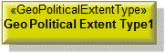
When shown on an
AV-4 Environmental Model, a Geo Political Extent Type appears as follows:
Relationships
The following relationships are of importance to a Geo Political Extent Type:
• Used as a conveyed classifier for
Operational Exchange elements.
The following sections provide information about how a Geo Political Extent Type is used in the model.
Create a Geo Political Extent Type from


Create from a Geo Political Extent Type
In addition to the UPDM elements that can be created from all UPDM elements (
Representation,
Definition,
Information, and
Metadata):


Shown on these diagrams, tables and matrices
In addition to the
AV-2 Integrated Dictionary and
StdV-1 Standards Profile, which can show all UPDM elements:


UPDM writeable properties
The following writeable properties are available on the Geo Political Extent Type tab of a Geo Political Extent Type element's Property Pages:
• customKind
• geoPoliticalExtentKind
• URI